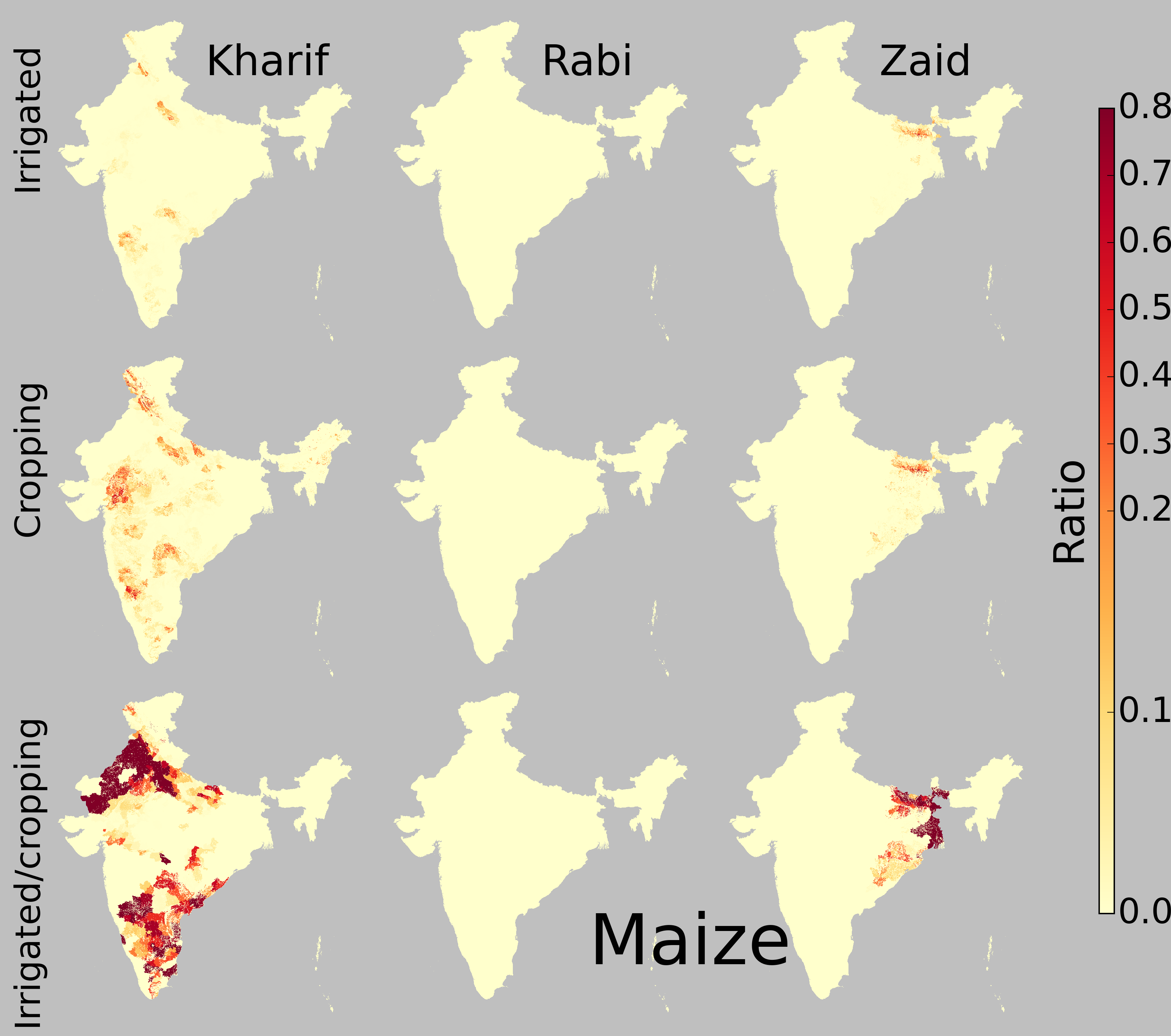
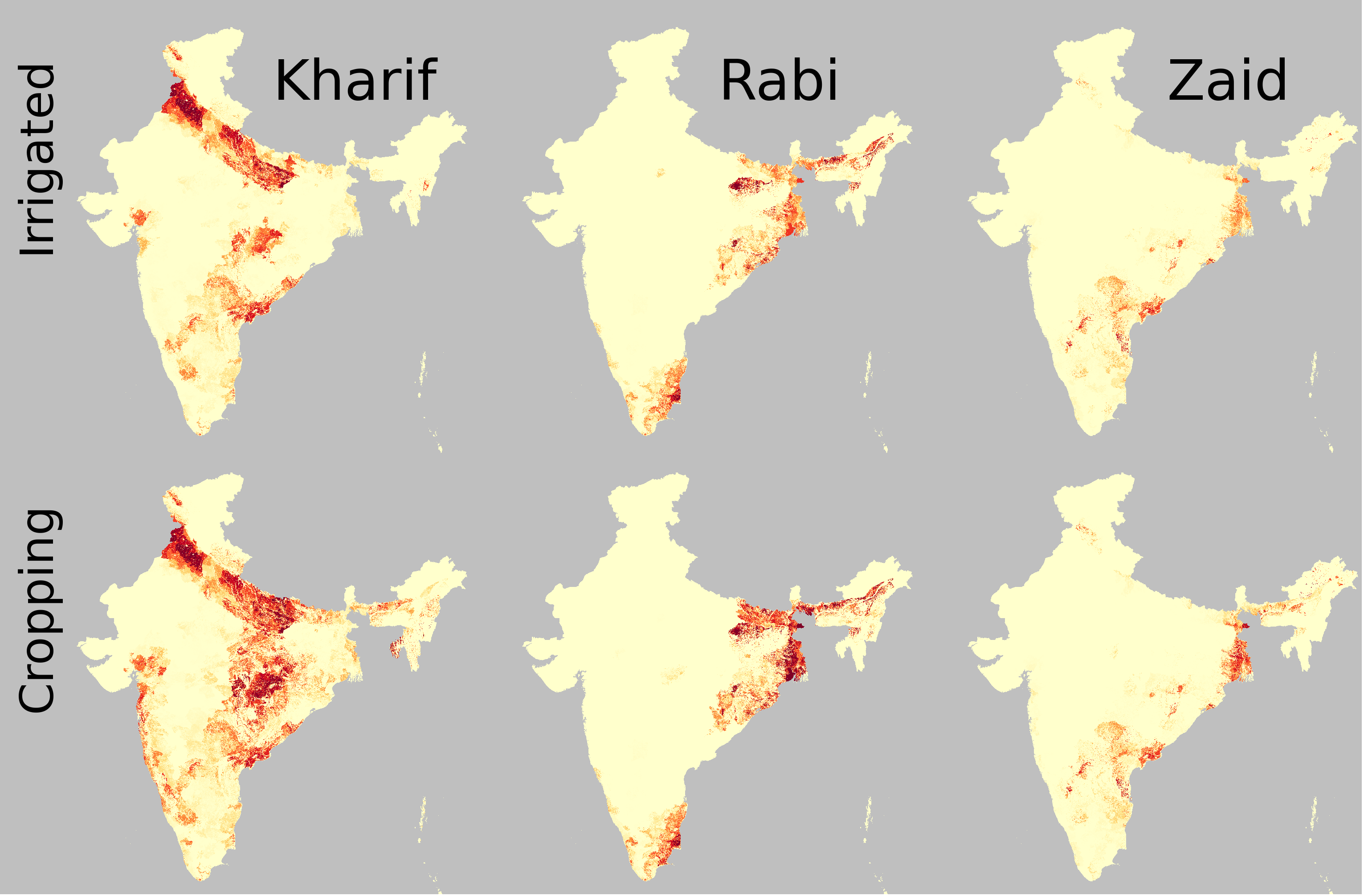
Season-wise irrigated and rainfed crop areas for India around year 2005
Crop growing area and irrigated fraction for 21 crops in Kharif, Rabi and Zaid seasons for India around year 2005 in 500 m spatial resolution.
Additional materials available
Version 1.0 - published on 15 Jan 2015 doi:10.13019/M2CC71 - cite this
Licensed under CC0 - Creative Commons

Description
The spatio-temporal pattern of cultivated crops varies considerably in India and is strongly determined by varying balances of water supply and demand across regions and seasons. The positive balance between precipitation and potential evaporation in the Kharif (monsoon) season lasting from June to October allows to grow one rainfed crop in most parts of the country, while there is a high water deficit in the Rabi season (November to February) and in the pre-monsoon season (Zaid, March to May). Therefore, irrigation is essential for crops in the Rabi and Zaid seasons to reduce drought stress, while it is only supplementary in the Kharif season across most of the country. This kind of knowledge and information are vital for natural resources management and climate change impact assessments. This study aims to map the rainfed and irrigated cropping area for 21 crops by integrating remotely sensed land use and land cover (LULC) data, crop calendars and survey based census data.
Content List ( Show bundle contents ) Bundle
 Geoshare_pilot_irrigation_cropping.zip(ZIP | 1 GB)
 Technical report describing the data set development(PDF | 3 MB)
Cite this work
Researchers should cite this work as follows:
- Zhao, G., Stefan Siebert (2015). Season-wise irrigated and rainfed crop areas for India around year 2005. MyGeoHUB. doi:10.13019/M2CC71
Tags
Geoshare

This publication belongs to the Geoshare group.