
In the spotlight
Congratulations to the AgMIP tool development team! Their paper titled "Rapid aggregation of global gridded crop model outputs to facilitate cross-disciplinary analysis of climate change impacts in agriculture" was accepted by Journal of Environmental Modelling & Software. It appeared on pages 193-201 in Volume 75, January 2016
Check out a newly published paper "The role of international trade in managing food security risks from climate change" to learn about the exciting research work empowered by the AgMIP Data Aggregator tool!
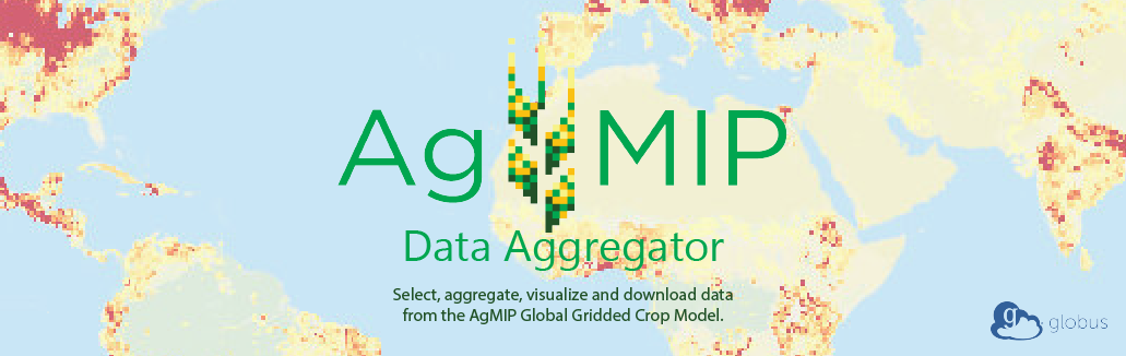
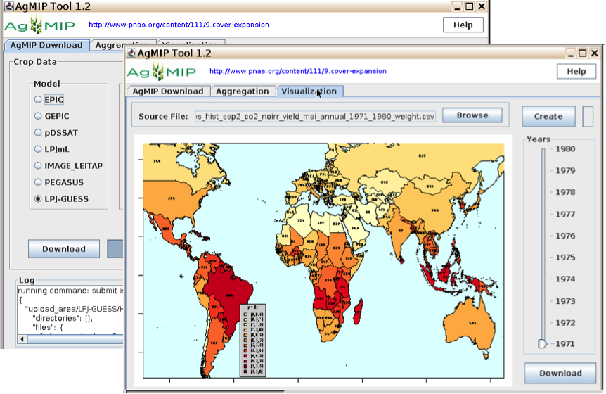
AgMIP Data Aggregator - Easy access to AgMIP data archive using Globus
The AgMIP data aggregator provides a graphical user interface for any user to select, aggregate, visualize and download data from the AgMIP Global Gridded Crop Model Inercomparison output archive of time series 1971-2099.
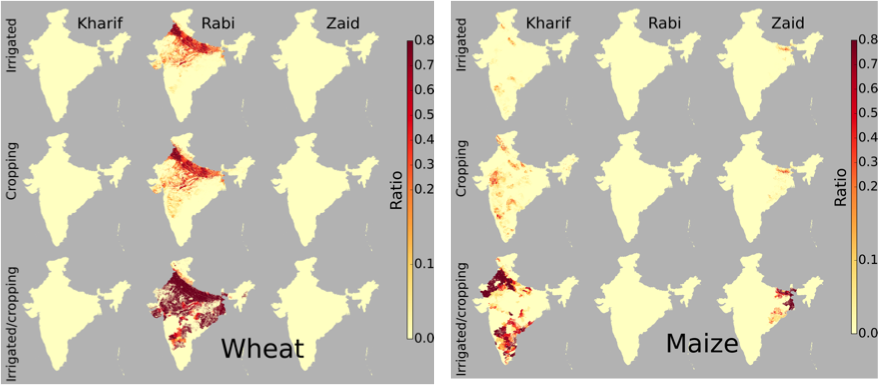
Season-wise irrigated and rainfed crop areas for India around year 2005
This dataset covers crop growing area and irrigated fraction for 21 crops in Kharif, Rabi and Zaid seasons for India around year 2005 in 500 m spatial resolution. It was published by the GEOSHARE pilot project with doi:10.13019/M2CC71.
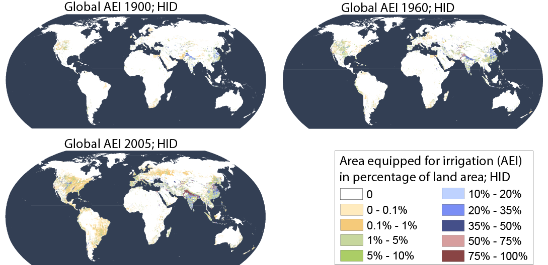
Historical Irrigation Dataset
This global dataset includes the extent of area equipped for irrigation (AEI) for 1900 to 2005 in 5 arc-minute resolution. The group developed eight gridded versions of time series of AEI by combining subnational irrigation statistics with different data sets on the historical extent of cropland and pasture.
Announcements
GEOSHARE Prospectus and GEOSHARE Workshop Synthesis ![]()
Joint workshop from GEOSHARE and CIMSANS:
Improving Geospatial Data for Decision Making and Discovery
in Agriculture, Resources and the Environment (GEOSHARE) 10-11 September 2014
Improving Food System Sustainability Modeling. 11-12 September 2014
Data
Geoshare facilitates remote collaboration for improving geospatial data.
Season-wise irrigated and rainfed crop areas for India around year 2005 - Crop growing area and irrigated fraction for 21 crops in Kharif, Rabi and Zaid seasons for India around year 2005 in 500 m spatial resolution ![]()
Historical Irrigation Dataset - A global dataset of the extent of irrigated land from 1900 to 2005 ![]()
Tools
Researchers can upload and share their scientific tools to share within the community. Try AgMIP: a tool for aggregating global gridded crop Model output and Pegasus: a global crop model. Click the launch button, and start computing.
Build your own tool in your favoraite coding language in our DIY area to use your own tools on Geoshare.