Project (GABBs 1.0)
Use Cases -- Development -- GABBs Building Blocks -- Applications
Use Cases
This page lists the scientific use cases that drive the GABBs development at present. Throughout the project, the GABBs continues to engage new and potential users and diverse communities to identify additional needs and requirements. New requirements are considered as part of our prioritization process and integrated into the schedule as necessary.
Hydrologic Modeling Workflow and Interoperability
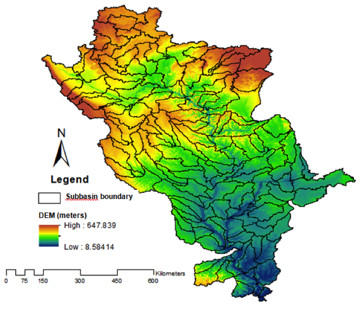
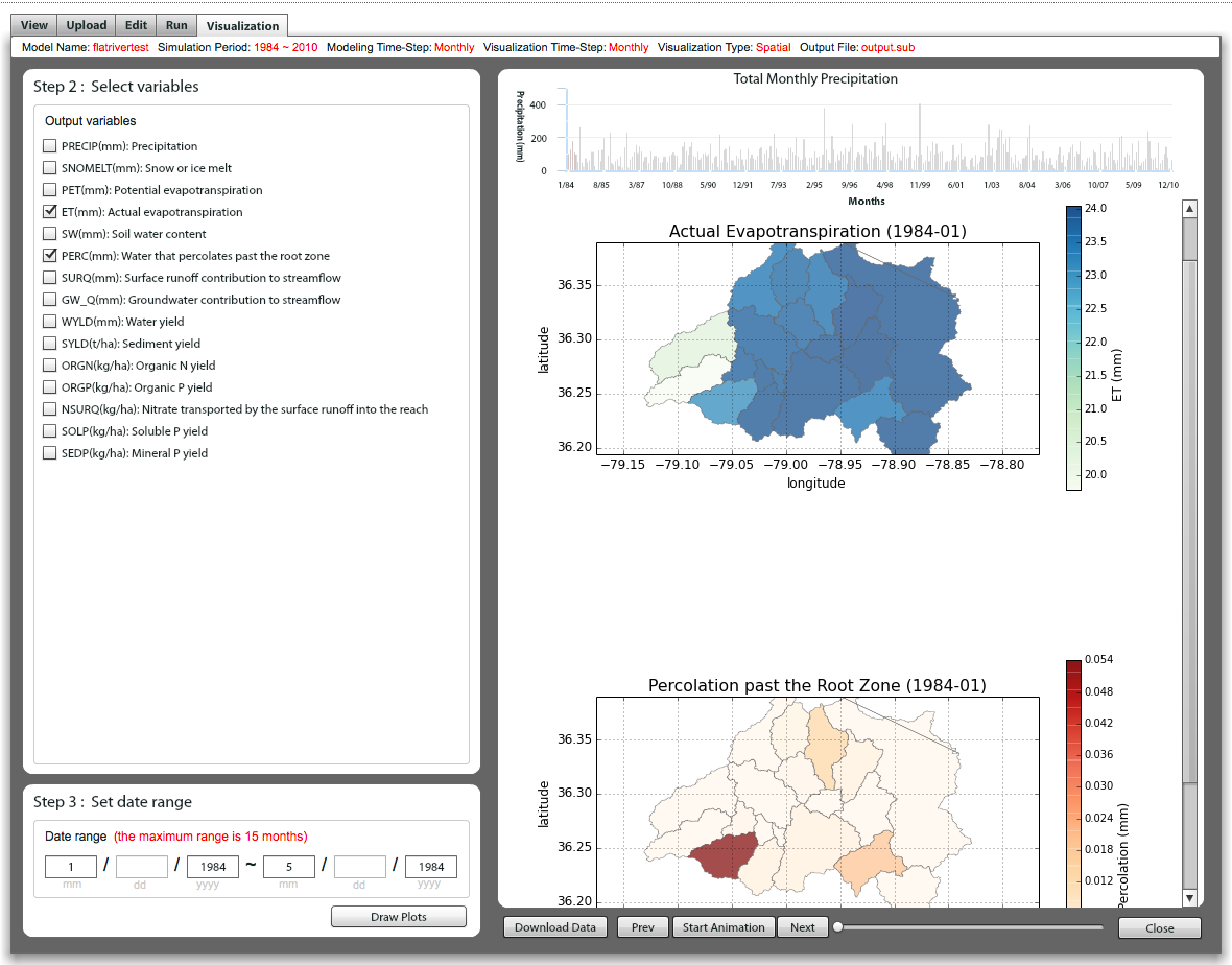
The GABBs tools have been used to address problems involving multi-scale and multi-disciplinary data and models for hydrologic research. More specifically, the science application involves flood modeling and visualization for the Mississippi River Basin using GABBs geospatial building blocks. Its workflow includes creating a SWAT hydrology model for the upper Mississippi River Basin, calibrating the model, running the model, and using the output to drive a 2D hydraulic model for all the river reaches in the basin. During implementation, the following GABBs building blocks have been used in managing SWAT model output, constructing workflows, and data visualization: iData, pyMapLib, and RAPPTURE map rendering engine.
In collaboration with the NSF funded HydroShare SI2 project, work has been carried out in building interoperability between GABBs and HydroShare to bring GABBs capabilities to the Hydrologic modeling resources managed in the HydroShare system.
Applied Economics Data Processing and Modeling
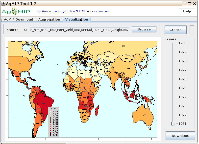
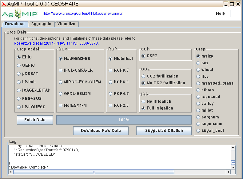
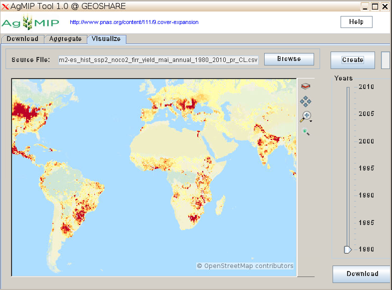
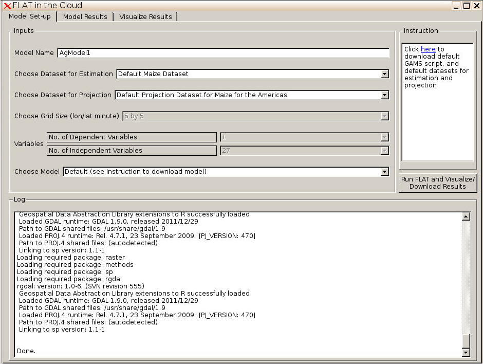
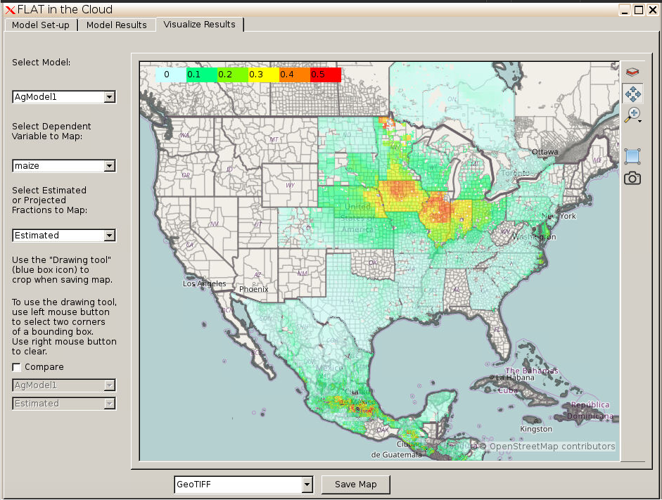
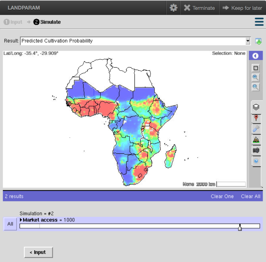
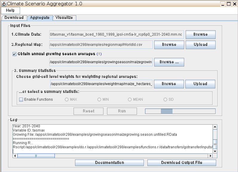
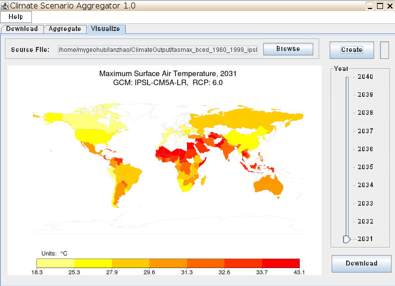
The GABBs building blocks helped increase data usability and the development of a GTAP (Global Trade Analysis Project) workflow to study the impact of climate change on global agricultural productivity and food security. The main objectives include developing reusable software modules and services that enables data sharing and building complex workflows of data processing, modeling and analysis. As a starting point, an AgMIP data aggregator tool and a Climate Scenario Aggregator tool have been developed to facilitate access and modeling use of a large collection of global gridded data for climate impacts on crop yields produced by the Agricultural Model Intercomparison and Improvement Project (AgMIP) and climate data generated by the CMIP5 initiative. They integrate with the GABBs iData component via its web service API, allowing users to import/output data between the tool and iData with metadata automatically captured and recorded. Furthermore, the PyMapLib building block has been used to develop a Fine-scale Land Allocation Tool (FLAT) for downscaling national agricultural data to the grid cell combining pixel level biophysical measurements and statistics processing. The development of the LANDPARAM tool for aggregating cropland supply and land transformation elasticities has been one of the main use cases that drives the design and development of the Rappture mapping library.
Multi-dimensional Atmospheric Data Exploration and Visualization
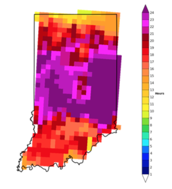
In this use case the GABBs building blocks have been used to develop dynamic applications on weather modeling data exploration and analysis. The applications extract weather related variables (e.g., precipitation, accumulation, duration, wind speed, etc) from large volumes of hourly gridded meteorological model output, analyze the data, and present GIS-enabled interfaces for users to query and visualize information related to severity weather. The PyMapLib building block was used to easily embed a map viewer widget in the application for rendering weather data on a map as well as interactive data exploration.
Digital humanitarian information services
In this use case, GABBS building blocks are being developed to facilitate the need on social media data (Twitter, wikipedia) processing and visualization using the HUBzero platform. It will enable dynamic construction of pipelines including data subscrition, processing, storage, indexing, and analysis.
Sensor Data Management
Purdue's Phenotyping projects (e.g., ARPA-E Terra) aim at building the next generation automatic plant phenotyping systems, using techologies including hyperspectral, #D,thermal, and fluorescent data sample acquisition, smart robotic sensors arms for localized precise measurements, cutting edge plant image processing algorithms, and supercomputing capability for big data modeling. GABBs project is collaborating with researchers in developing building blocks to facilitate the workflow.
Remote Sensing Data Analysis and Modeling
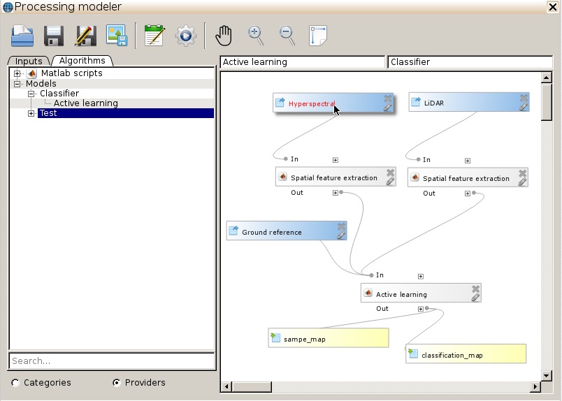
In this use case, an Active Learning Modeler tool is being developed for remote sensing data classification modeling and visualization based on a statistical learning model called Active Learning Framework. It builds on and integrates with GABBs building blocks such as model and data sharing via iData and dynamic workflow composition of geospatial data, algorithms, and models.
K-12 Education Tools
The open source HUBzero provides a cost-effective solution for data exploration that can be replicated at various institutions and accessed by researchers and educators all over the world. The geospatial analysis building blocks will be very helpful in a broad range of applications. One is in the development of geospatial training and educational material for undergraduate and even in secondary education. The easy to use, web-based applications created with these new tools in the HUBzero collaborative environment will provide K-12 students with engaging geospatial-based, on-line activities that improve comprehension of geography, GIS, and remote sensing. Inter-actives can be built around topics such as land-use/land-change using image data from the area that the students live in. The students will be able to display and compare changes in the landscape across time using inter-actives built with the proposed GABBs. We partner with Geography Educators' Network of Indiana, Inc. (GENI) to create educational tools using GABBs.
Development

Focus Areas
Mapping & Visualization Toolkit
This area includes the development of the PyMapLib Python mapping library, Geographic Data Viewer Builder (GeoBuilder), and Rappture Toolkit and GeoVis Render Services.
Data Management
This area includes the development of the iData User Interface for end users, and iData Service API for HUBzero tools and other resources to connect to data.
Scientific Applications & Tools
This area assists domain science application to integrate with GABBs and develops MultiSpec image analysis tool to support needs for image processing and visualization.
Latest development
Infrastructure
-
GABBs VM is available for download with main GABBS software packaged inside, Nov. 2016
- MyGeoHub is switched to use production GeoVis render servers, May 2016
-
MyGeoHub.org went into production, Oct. 2014
-
Disk space was added to allow for a larger local PostGIS database
-
GeoVis render server testing for performance conducted
Mapping and image widgets for Rappture Toolkit
-
The GeoVis render server protocol and Rappture Map object were extended with features to support 3D data use cases including terrain mask layers, elevation queries, ephemeris time configuration for sky lighting, etc. (Nov. 2016)
-
The option to zoom to a layer's extent was added as a button in the Rappture MapViewer widget and as a configuration parameter in the Map object for the initial camera view. Explicit map extents are also supported for setting the default camera view. (Oct. 2016)
-
Documentation of the Rappture Map element and MapViewer API were added to the Rappture wiki and are being updated.
-
Work began to expand the capabilities of the Rappture mapping library and map render server driven by the requirements coming from the HydroGlobe use case. (July 2016)
-
The Rappture mapping library and map render server has been integrated into GeoBuilder to support self configuration and exploration of geospatial data using a wizard guided interface. (May 2016)
-
PyMapLib version 1.0 has been released and is accessible from github. (Feb, 2016)
-
Continue to investigate and prototype using OSGEarth (on the server side). OSGEarth allows for automatic handling of projected and geocentric 2D and 3D maps. GDAL/OGR being used to output shape files. Work continues on defining the linkage between GDAL/OGR and Rappture. An interface is being prototyped.
-
The work on expanding the “building blocks” using Mapnik including access to the postgres image server, loading in csv data file(s), and allowing mash-ups with data and base map(s)
-
OpenStreetMap data for the entire world were loaded into the PostGIS server to be available for testing the Mapnik building block and for the science driver use cases
iData development (linkage between tools and datasets)
-
iData geospatial data search function is integrated into the new solr based overall Hub search implementation.
-
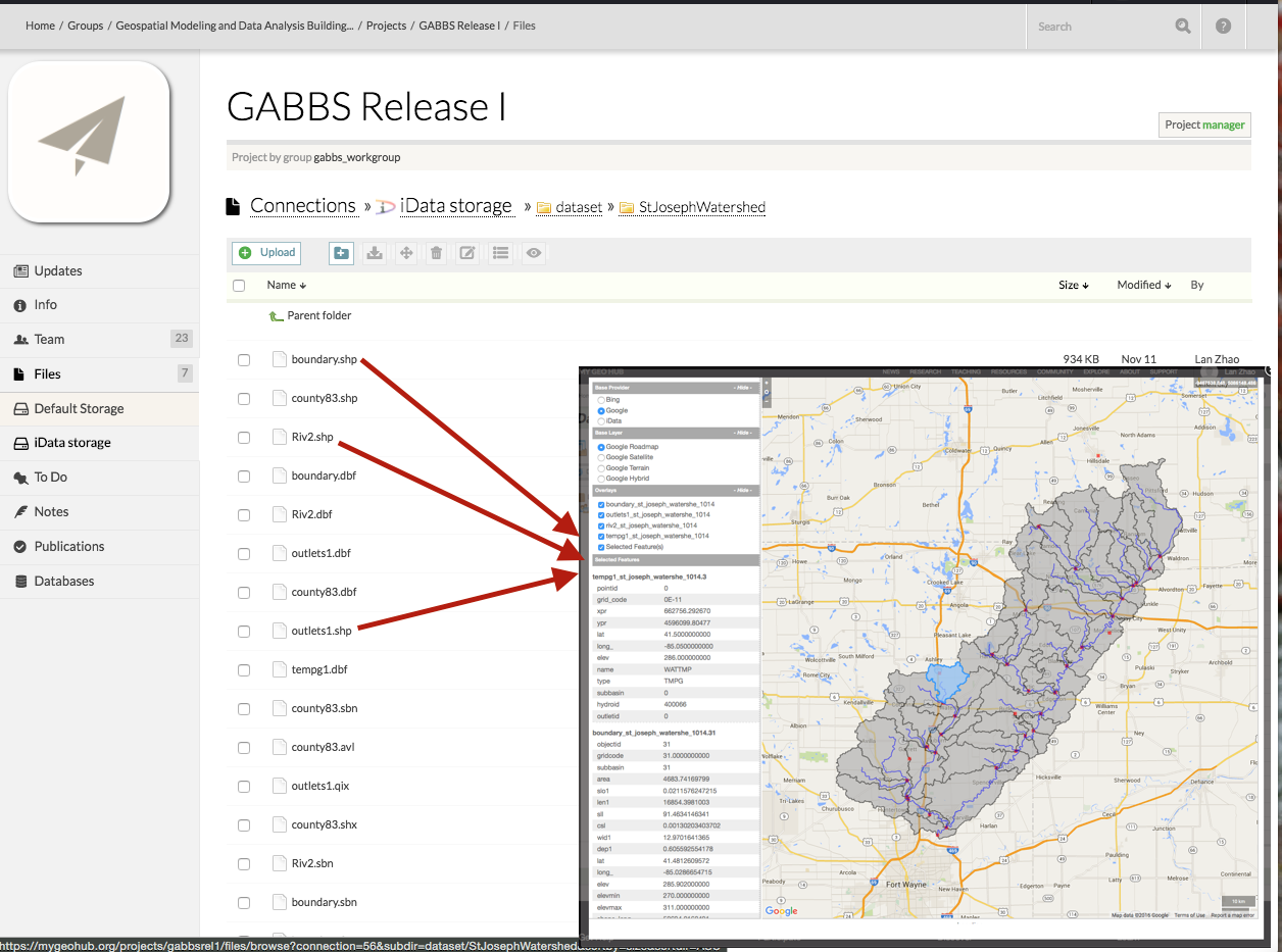
iData Data management system has been integrated into the Hub Project Files. Data management functions including preview (map, csv, text files, image files), metadata edit, publication, tool launching are completed.
-
iRODS file system is FUSE mounted to both the Hub web server and tool container for consistent and efficient file handling.
-
The development of data services and iData GUI continue. The service interface for data browsing, upload, download, and metadata registration have been completed and have been used in the AgMIP and SWATShare use cases.
-
Significant progress was made to implement a basic geo visualization viewer using OpenLayers that will allow users to see an interactive rendered map of selected geospatial files in iData. It also allows users to overlay multiple vector and raster maps and display the attribute table associated with a selected vector feature. This geo visualization viewer is a generic module that is used for map rendering in iData as well as in the HUBzero “Project” plugin.
-
Work continues on the link between third party applications/hub tools and iData using AgMIP and SWATShare as the initial components for the development. These two use cases also drove the design and implementation of the iData web service API. The integration between iData and SWATShare is close to completion. It allows SWATShare users to easily browse and import SWAT models from iData, execute the model using the Purdue Condor pool or XD resources, analyze model output, and then export model output to iData with automatically recorded metadata.
-
Work also started to implement the mechanism for supporting launching of a workspace tool from within iData using iData files as input.
-
The iData component has been deployed at the dev MyGeoHub site. The team is in the process of deploying a stable version of iData at the stage and live sites.
Leveraging MultiSpec for handling multispectral images
-
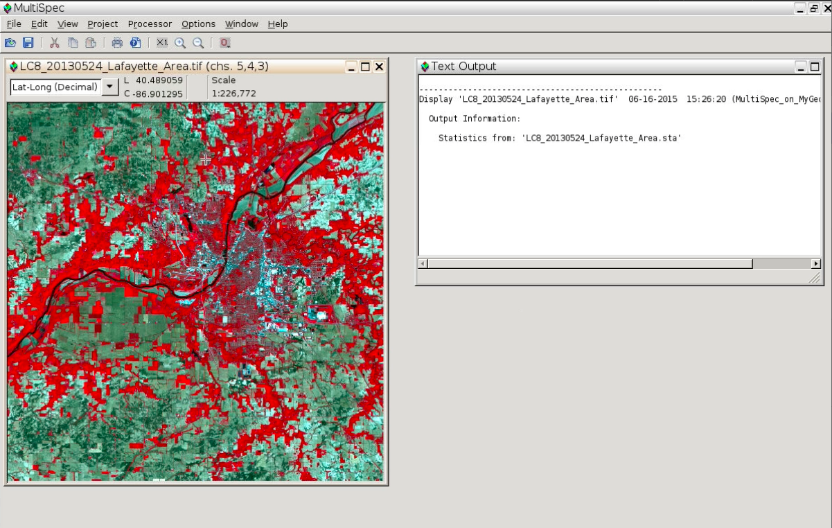
The version of MultiSpec in the hub workspace now includes the cluster analysis controls. Work will continue to make MultiSpec in the hub workspace a published tool, add the ability to display thematic style images, add the GDAL library to handle additional image file types and expand the functionality to allow for linkages with iData.
GABBs Building Blocks
iData
The second version iData has been integrated into Hub Project File and is now available! It allows individual researchers to upload, browse, discover, share and publish scientific data all by themselves as well as to launch tools directly from the iData file browser. What's more, it comes with value added features for geospatial data.

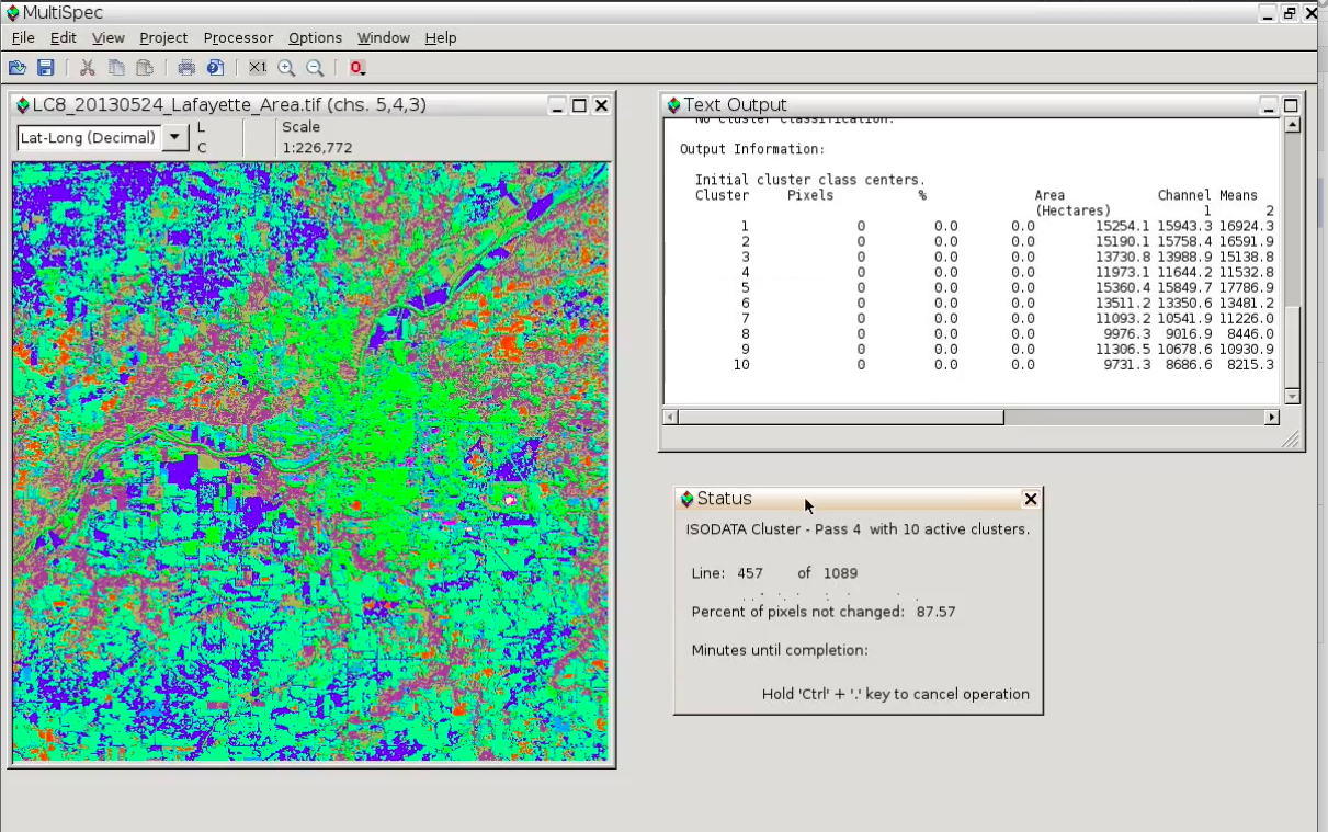
MultiSpec
The MultiSpec Online tool brings image processing capabilities online for displaying and analyzing geospatial images. Features include unsupervised and supervised classification, principal components, overlay shape files, reformatting processors such as create vegetation indices, rectify, mosaic, & change image file format, handle multispectral and hyperspectral image data and others.
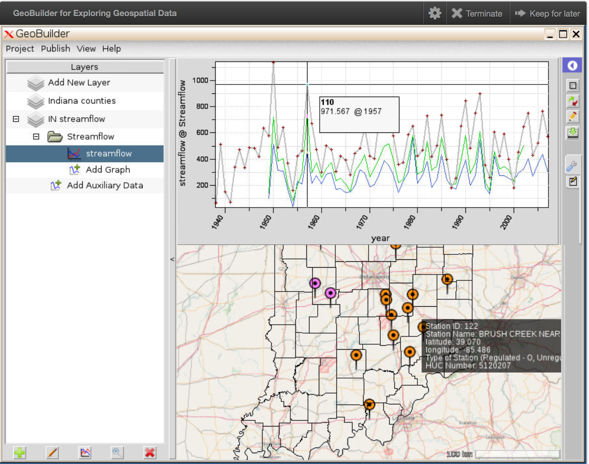
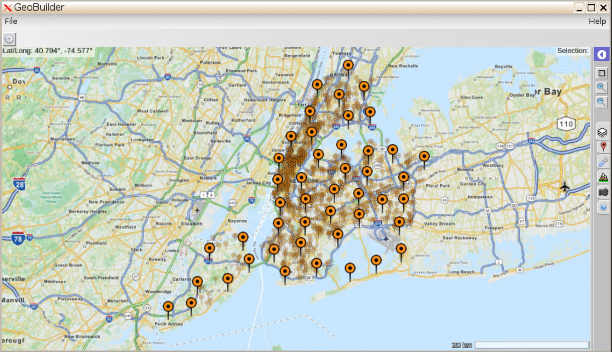
GeoBuilder
The GeoBuilder Tool demonstrates some of the geospatial building blocks currently in development. It also serves a convenient tool for non-expert users to quickly display and explore data using a map interface. What's more, users can share their configured data view with others, all without writing a single line of code.
Applications
SWATShare
Import/export SWAT model input and output between SWATShare and iData. Launching SWATShare from HydroShare SWAT model resource landing page for data analysis. Model sharing between SWATShare and HydroShare.
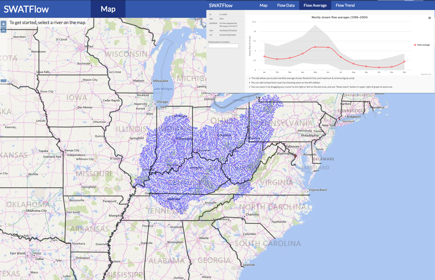
SWATFlow and Streamflow Viewer
A platform for providing high resolution river flow information for enhanced water resources management, education and research.
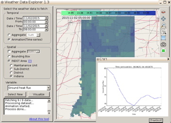
Weather Data Explorer
An interactive application for accessing and visualizing Winter Weather Database (Wintx) for the INDOT areas.
AgMIP Data Aggregator
Enable easy access and utilization of AgMIP model output by integrating iData, Globus Online, R software, and GABBS map rendering functions.
Fine-scale Land Allocation Tool (FLAT)
Downscale national agricultural data to the grid cell combining pixel level biophysical measurements and statistics processing.
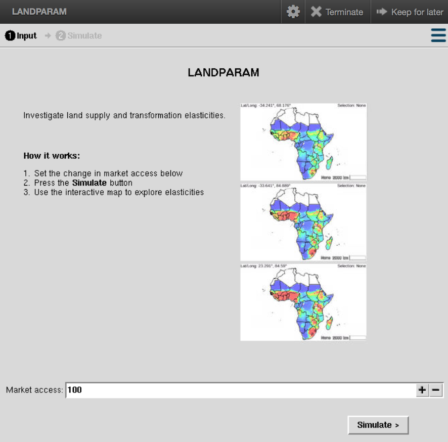
LANDPARAM
A tool to aggregate cropland supply and land transformation elasticities.
Climate Scenario Aggregator
Reduce the technical barriers to access fundamental climate date through a web-based facility that facilitates downloading and aggregating global grids (0.5 degree) of bias-corrected, monthly mean historical and future temperature and precipitation from the five General Circulation Models (GCMs) used by the Inter-Sectoral Impacts Model Intercomparison Project (ISI-MIP).
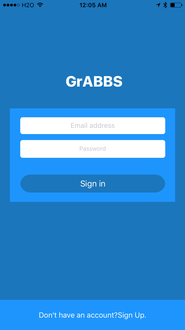
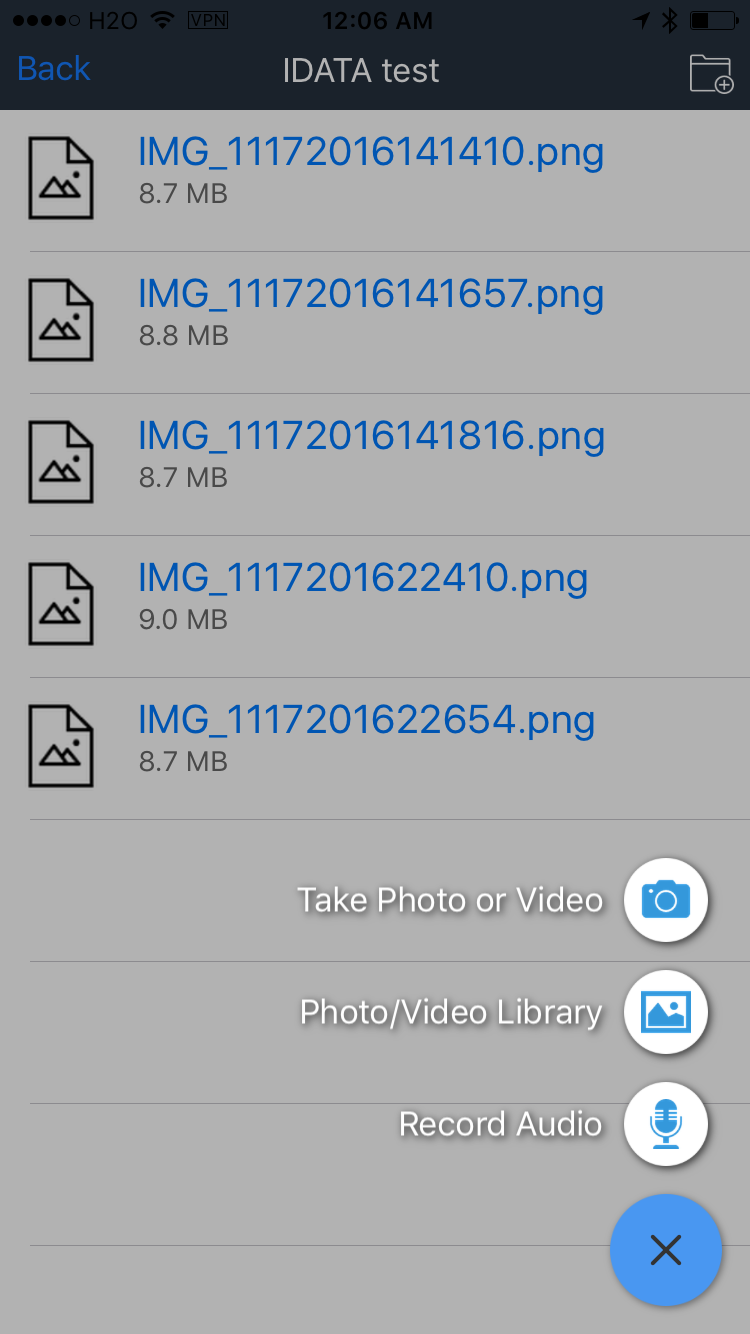
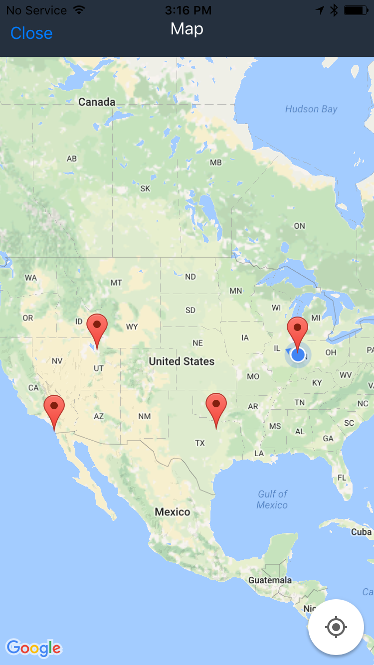
GrABBs
An iPhone/Android app that makes it easy for field workers to upload data from mobile devices to the iData system.
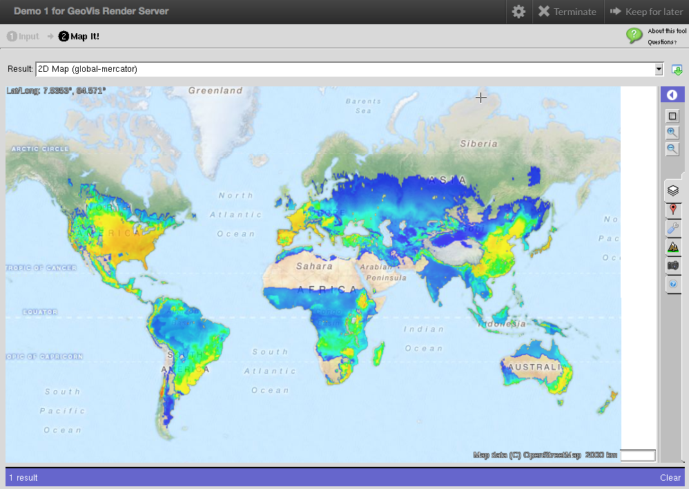
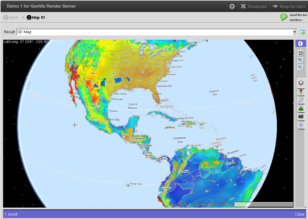
GeoVis
A GeoVis render server providing interactive visualization.
Metadata Exporter
A Jupyter notebook tool that exports the Dublin Core and user defined metadata for a geospatial file from iData to the ISO 19115 standard. The resulting metadata is saved to an XML file that follows the ISO 19139 XML schema. ISO 19115 metadata is the standard employed by several organizations and GIS tools including the commercial ArcCatalog application from the ArcGIS suite of products.

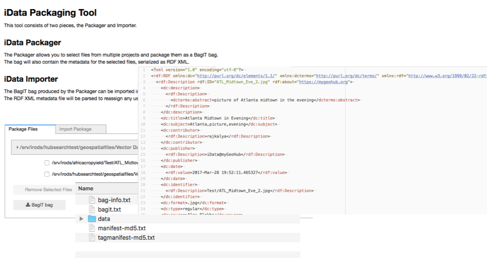
iData Packager
A Jupyter notebook tool that supports packaging iData files from different projects for download and transfer outside MyGeoHub or for subsequent re-upload to a different hub project. The metadata for the files being packaged is serialized and saved as an RDF XML document along with the files themselves. The package utilizes the BagIT convention which is utilized by the Library of Congress, digital libraries and science gateways such as HydroShare. BagIT also forms the basis of the BagPack format recommended by the Research Data Alliance's Research Data Repository Interoperability Working Group for digital data transfers between data repositories.