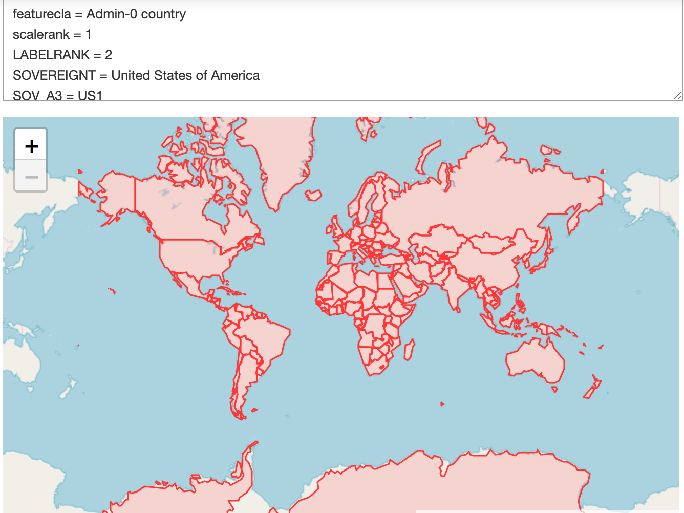
GeoEDF Use Cases
This page lists the scientific use cases that drive the GeoEDF development at present. Throughout the project, we continue to engage new and potential users and diverse communities to identify additional needs and requirements. New requirements are considered as part of our prioritization process and integrated into the schedule as necessary.
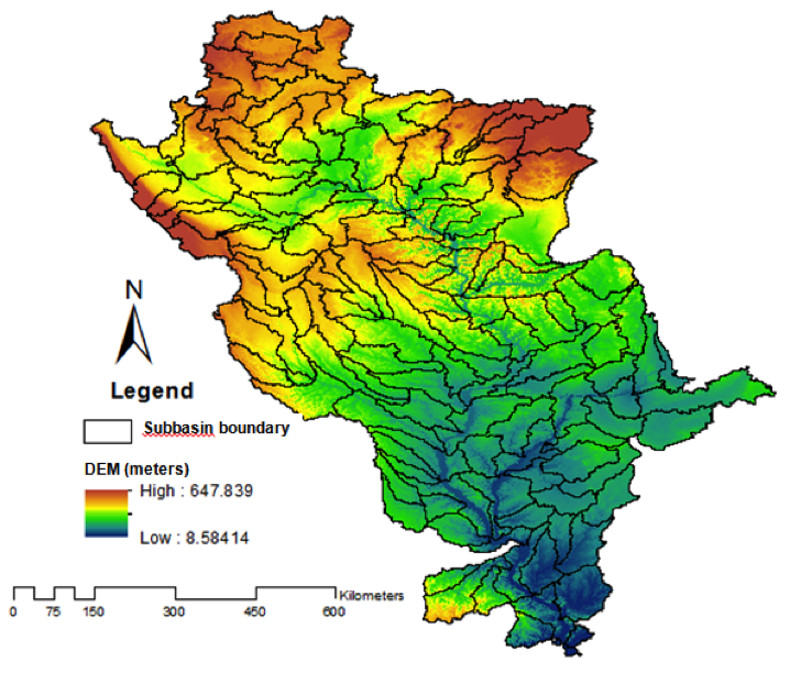
Near Real-Time Flood Modeling at Multiple Scales from Major Rivers to Urban Streets
The GeoEDF framework will be used to address problems involving multi-scale and multi-disciplinary data and models for hydrologic research. More specifically, this science use case will use a state-of-the-art integrated hydrologic model called Interconnected Channel and Pond Routing, ICPR to create a multiscale modeling platform using the GeoEDF framework.
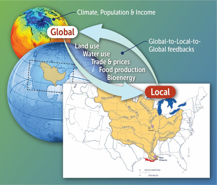
Global to Local Food Security and Sustainability Research Connecting Climate Data and Social Science Data with Crop Modeling
Assessment of local and global sustainability goals requires fusing ecological and environmental data generated at local scales with global/national/regional socio-economic data that in turn are used as inputs in global computational economic models. The interdisciplinary nature of this research raises several challenges. This project will significantly reduce these barriers by developing sample tools that would allow users to access and process relevant geospatial data for global sustainability analysis (such as gridded land use and land cover data, water scarcity, climate variables and climate change impacts). We will then connect these tools to an existing open-source global agricultural economic model, SIMPLE-G.
Real Time Data Collection, Processing, and Decision Making using Crowdsourced Crop Data
In this use case we will develop a platform for real-time crop growth sensor data collection, processing, and exploration from the distributed handheld sensors using the GeoEDF framework, which can be extended to manage other crowdsourced data.

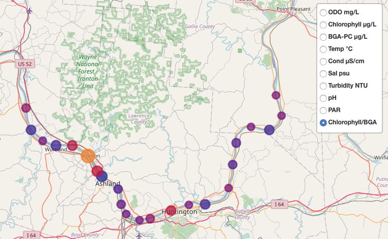
Managing Water Quality Data Collected from Field Sensors
Managing freshwater quality across a large watershed requires coordination among multiple entities with historically different goals and practices where local interests and priorities have too often outweighed those for the larger good. Two large NSF EPSCoR projects—spanning academic institutions and interacting with various federal, state and municipal agencies and citizen watershed groups are now actively engaged in breaking down these barriers to help better understand the freshwater systems in Central Appalachia, primarily in West Virginia. In this use case, we will install GeoEDF in a third-party hub to address challenges of managing water quality sensor data from multiple sources.
Cyber Training and Workforce Development
In this use case, we are enhancing the HUBzero platform with novel capabilities to improve the online learning experience. These improvements include developing general purpose online tools for education purpose and implementing integrated data and tool functions in the HUBzero course module so that instructors can create online course outlines that seamlessly combine static teaching materials with dynamic data, tools, and interactive coding environments such as Jupyter Notebook and RStudio.