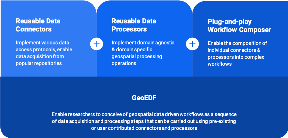
GeoEDF Development
Vision
Create an extensible geospatial data framework that will address the challenges by providing seamless connections among platforms, data and tools, hence making valuable, large scientific and social datasets in scientific models and tools.
The ultimate goal is to put easy-to-use tools and platforms into the hands of researchers and students to conduct scientific investigations following FAIR science principles.
Focus Areas
Data Connectors
This area includes the development of the Geographic Data Explorers (GeoExplorer), Geographic Data Viewer Builder (GeoBuilder for GeoExplorer), and Rappture Toolkit and Services.
Data Processors
This area includes the development of the iData User Interface for end users, and iData Service API for HUBzero tools and other resources to connect to data.
Workflow Engine
This area assists domain science application to integrate with GABBs and develops MultiSpec image analysis tool to support needs for image processing and visualization.
Interactive Learning
The focus of this area is to integrate the data building blocks and dynamic tool functions into the HUBzero course system to enable active teaching and online training for advanced computing and domain science areas.
